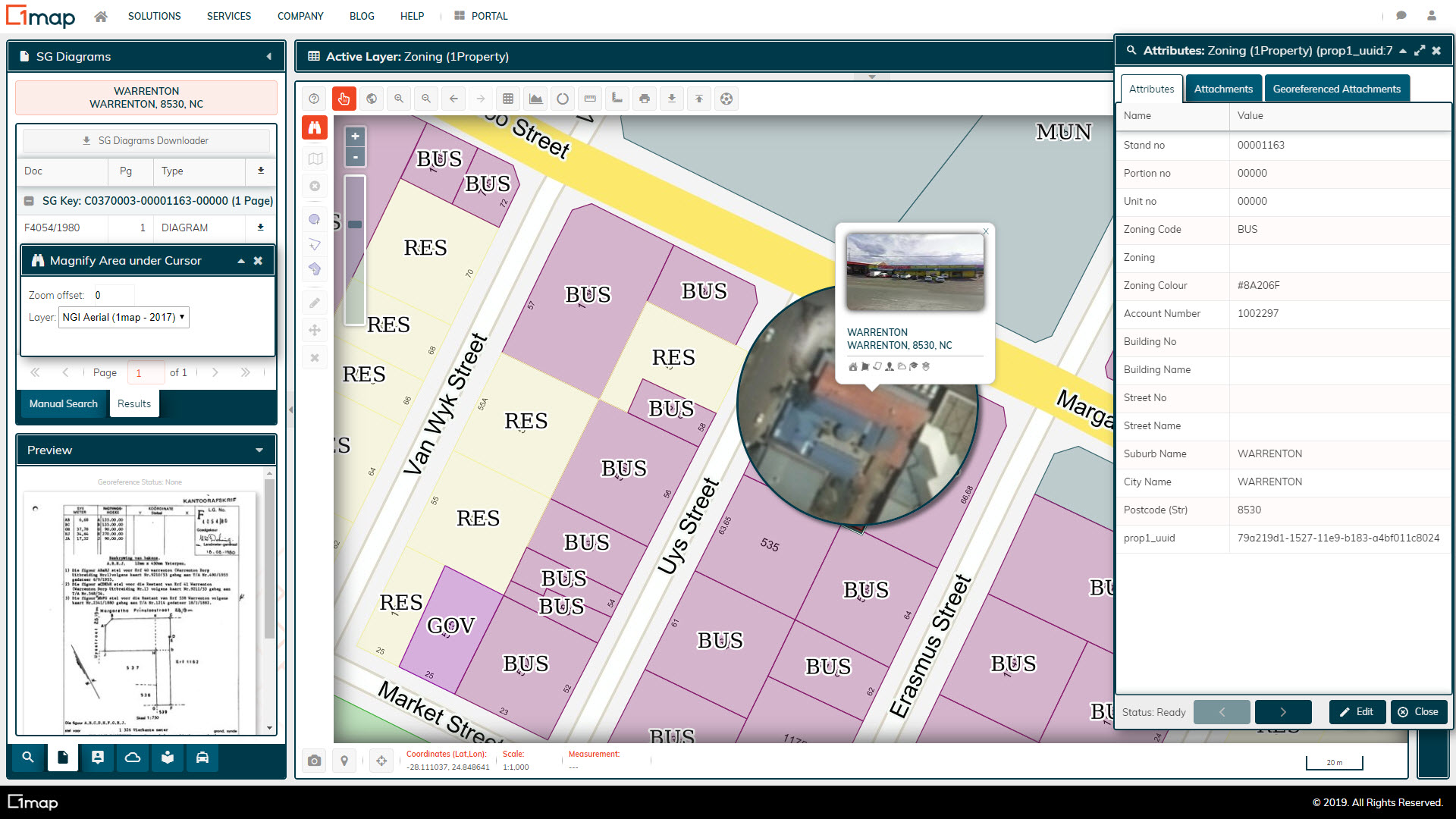
 A view of Warrenton, indicating the zoning for each property, with a magnifying glass view of aerial imagery to do quick desktop verifications.
Northern Cape Treasury
1map is used as a business intelligence platform as foundation for municipal turnaround projects at five municipalities in the Northern Cape as part of a project for Provincial Treasury.
 A user-friendly visual tool to display and edit the meter reading units.
City of Tshwane
1map has developed spatial tools to assist in optimising the meter reading process, leading to greater efficiency, municipal revenues, and service delivery.
 A 1map replication server runs on-site at the GSDM offices, giving them access to the latest available spatial data, empowering their GIS department.
Gert Sibande District
1map was appointed as a service provider to provide the Municipality with constantly updated spatial data to use as a foundation for their data analysis and GIS activities.
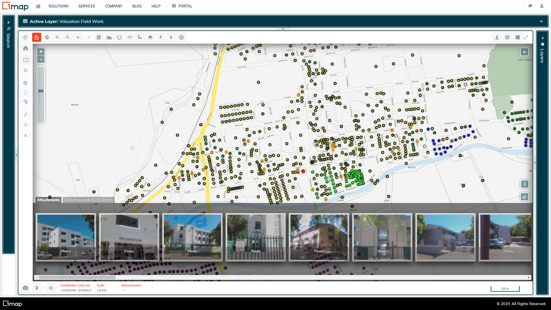 A view of Stellenbosch, indicating the inspection points, styled according to their attributes. The georeferenced attachments captured as part of the field work is indicated on the bottom of the screen.
Stellenbosch Local Municipality
1map provided a platform and mobile application for data collection and project management of the general valuation. This improved efficiency for the service provider, and provided the municipalities with spatially referenced valuation data. 1map also linked the financial system, map, ownership data, and valuation roll for the municipality.
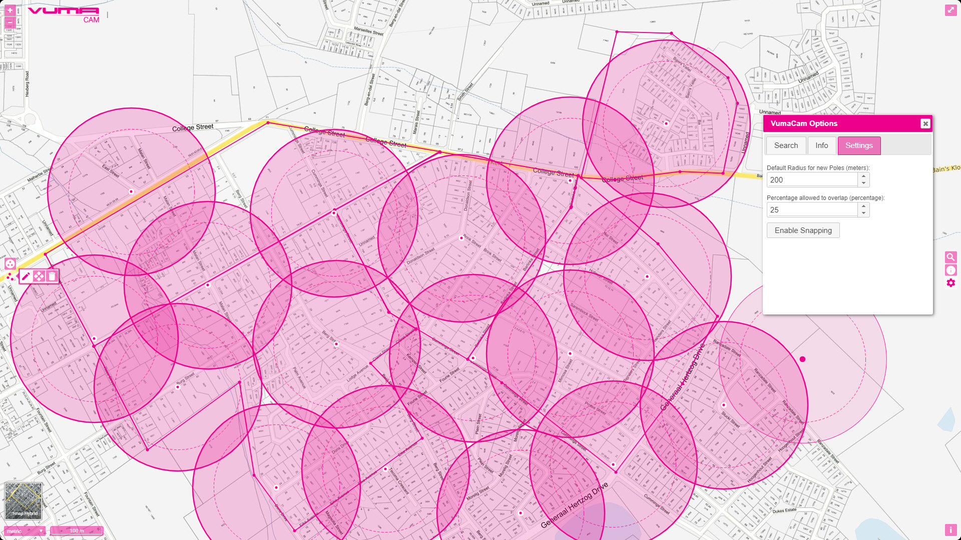 The user interface for capturing area polygons and individual wayleave points. The radius and allowable overlap for each point can be set dynamically.
Vumacam Wayleave App
1map developed a customised spatial application to greatly improve the efficiency of capturing information for wayleave applications.

MSCOA Data Enhancement
1map processed data from the municipal accounting system to standardise and clean the addresses, match the properties to the title deeds, and geocode the account holders as part of MSCOA readiness for a number of Sebata clients.
O R Tambo District Water Services
1map sourced and linked title deeds information for all registered properties in the O R Tambo District in order to assist in improving the meter reading process.
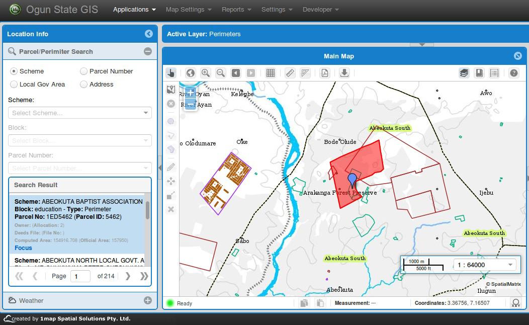 Ogun 1Map interface showing search panel with the panel and map showing the result of the search
Ogun State GIS: Nigeria
Ogun State in Nigeria started implementation in 2012 of their first digital Spatial Data Infrastructure (SDI). A custom implementation of the 1map Online GIS, with enhanced functionality such as a coordinate capture tool, was developed for the project.
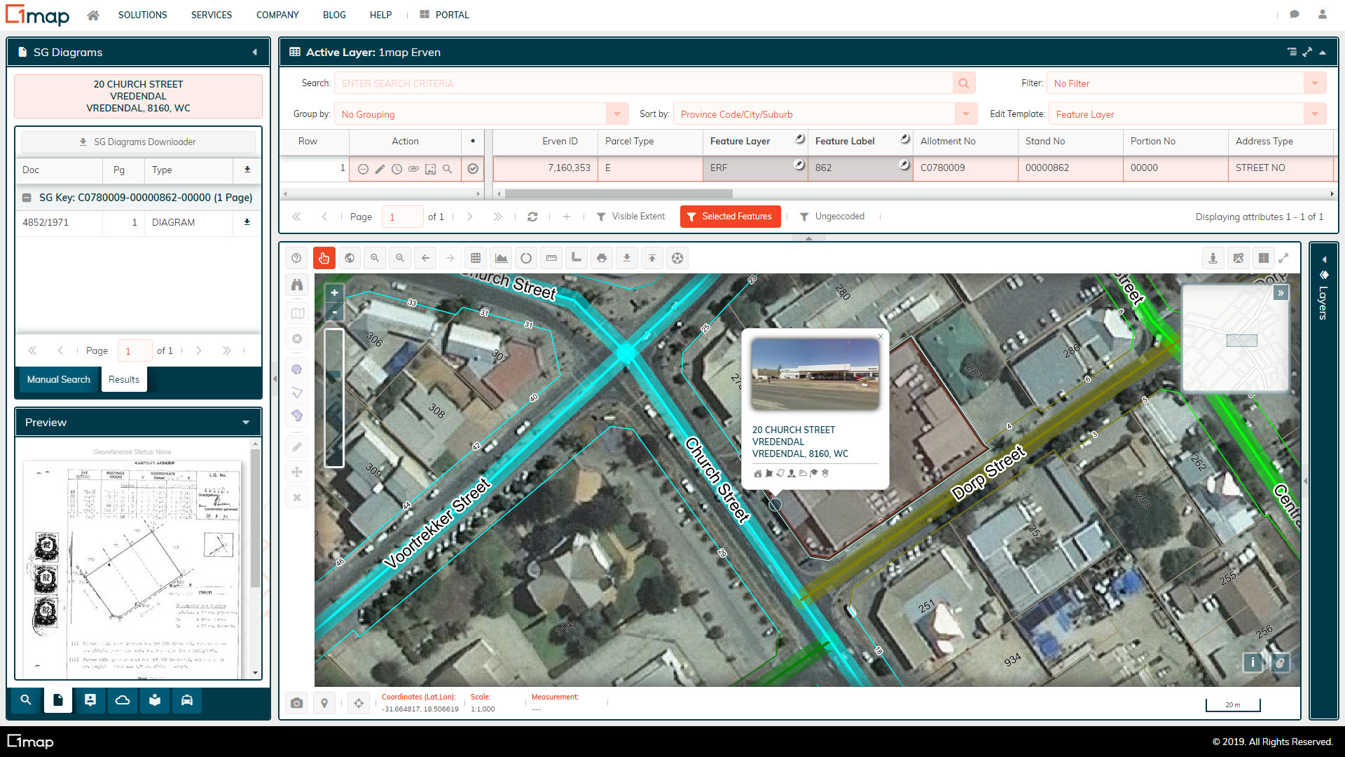 A screenshot of the Matzikama town center on the 1map Online GIS, showing the stand numbers, street addresses, road centrelines, SG diagrams, and NGI aerial imagery.
Matzikama Local Municipality
1map is used as the online GIS for Matzikamma Local Municipality, ensuring that all departments within the municipality that require access to spatial data have it at the click of a button.
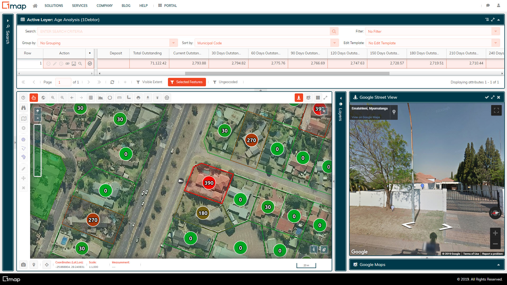 Debtors were linked to the map, allowing operators to inspect the properties of long outstanding municipal debts. The data is updated automatically every week, ensuring that only the latest data is used.
Nkangala District
1map has been contracted by a service provider to the Nkangala District Municipality to perform certain aspects of a tender related to enterprise GIS implementation across the District, specifically providing spatial context, and linking the financial systems of the various local municipalities to a map.
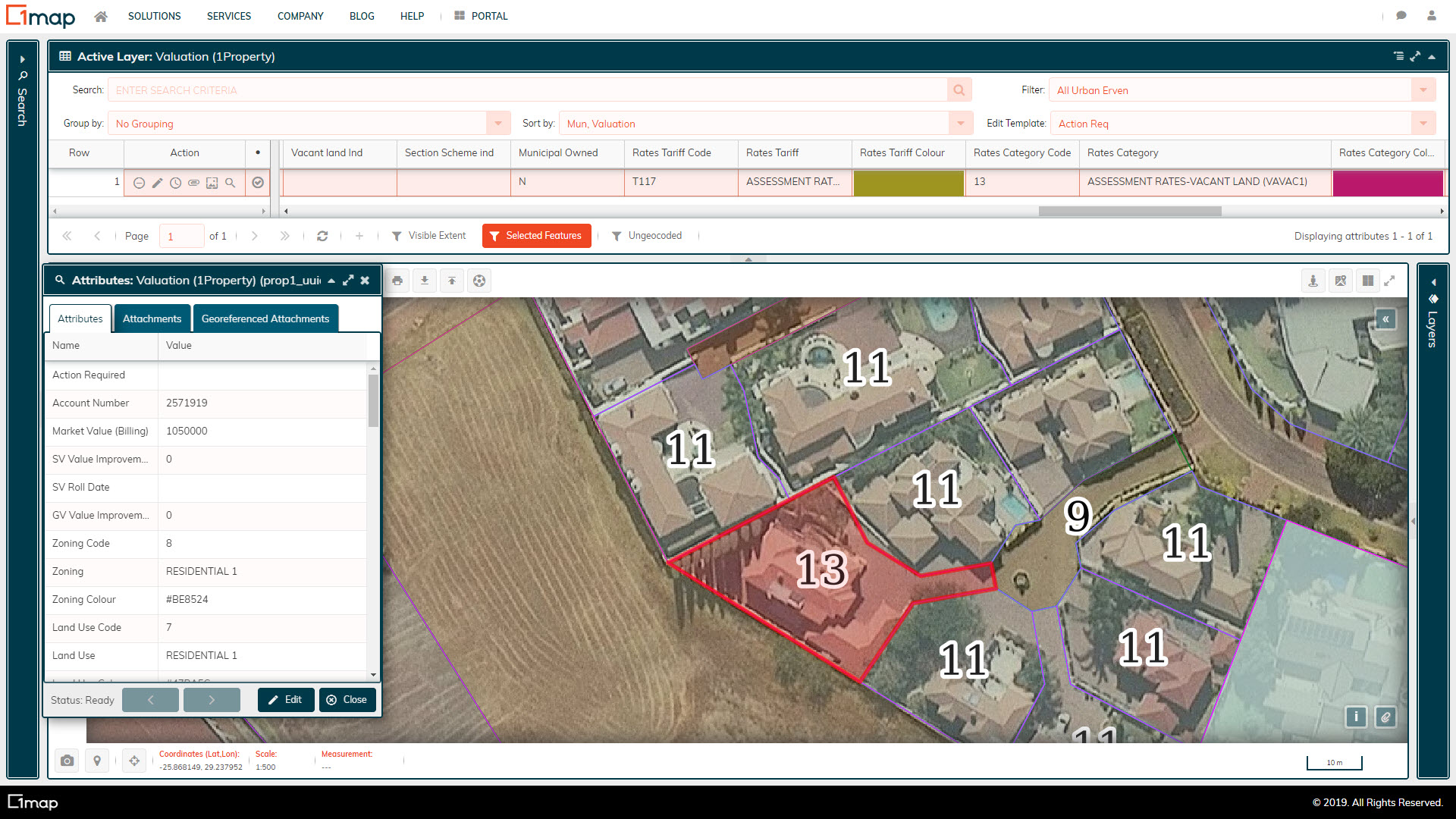 A property in eMalahleni with a rates category of "Vacant Land", and a valuation of less than half of its neighbours.
eMalahleni Revenue Enhancement
1map developed an integration module to allow for the direct integration of the Inzalo EMS financial system with the 1map Online GIS, letting revenue managers and consultants see account details (e.g. debtors ageing, etc.) on the map. More than R10m in lost annual revenue was identified within a space of 3 months.
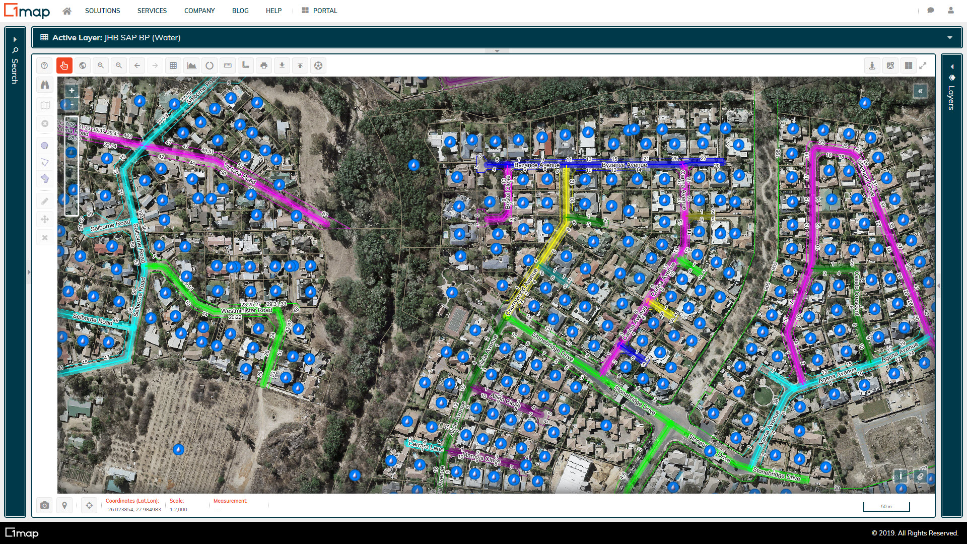 A screen showing the linked water accounts for the City of Joburg's SAP financial system.
City of Joburg
1map was contracted to provide data cleansing services for City of Joburg, linking all their SAP billing accounts to properties, cleaning billing and service addresses, etc.