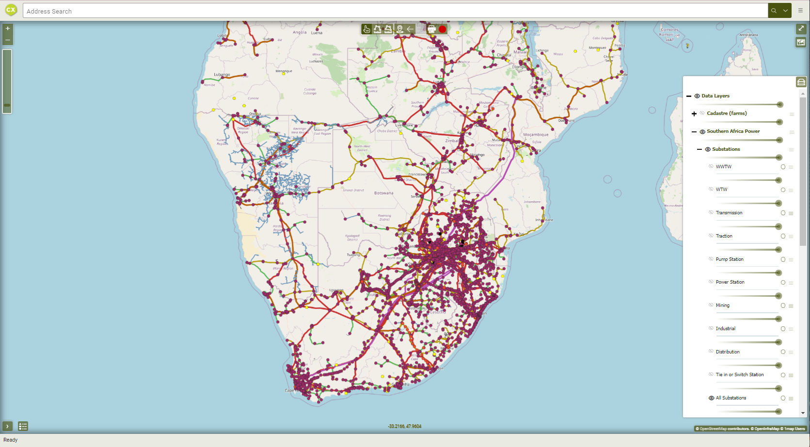
 AmaranthCX and 1map have joined forces to create AmaranthMaps, a platform providing a range of valuable maps focused on Africa.
Embedded maps for custom data layers
1map provides a platform on which the client can capture and maintain their vast datasets effectively and make them available to their clients on an interactive embedded viewer on the client’s website.
 1map demonstrated a unified data solution for the City’s Department of Technology, merging location data silos while preserving privacy and custodianship.
San Francisco Single Source of Truth
1map did a pilot implementation for the City’s Department of Technology to demonstrate the viability of a unified single-source of truth to consolidate the various data silos around location without compromising data privacy or segmentation of custodianship over specific data sets.
 Since consolidating their data and systems in 1map, Shout-It-Now has seen a marked increase in operational productivity. They now spend less time on the road and more time serving their patients.
Mobile Clinic Management
1map provides a spatial foundation for managing mobile clinics, schedules, and data analysis for an NGO helping communities with HIV and TB diagnosis, prevention, and treatment. 1map provides the client with a spatial view of their operating data, including their live and historic fleet tracking data, all on a single map interface.
 Our Emalahleni valuation analysis identified 500+ properties for updated valuations, boosting annual property tax by R9.6 million.
Optimizing Tax Revenue in Mpumalanga
We conducted a comprehensive analysis of Emalahleni in Mpumalanga’s valuation data for Provincial Treasury with the view of Circular 93 compliance. Through a combination of automated spatial identification and operator validation we confirmed more than 500 properties that required valuation updates. This resulted in an additional R9.6 million in annual property tax income for the municipality.
 A user-friendly visual tool to display and edit the meter reading units.
City of Tshwane
1map has developed spatial tools to assist in optimising the meter reading process, leading to greater efficiency, municipal revenues, and service delivery.
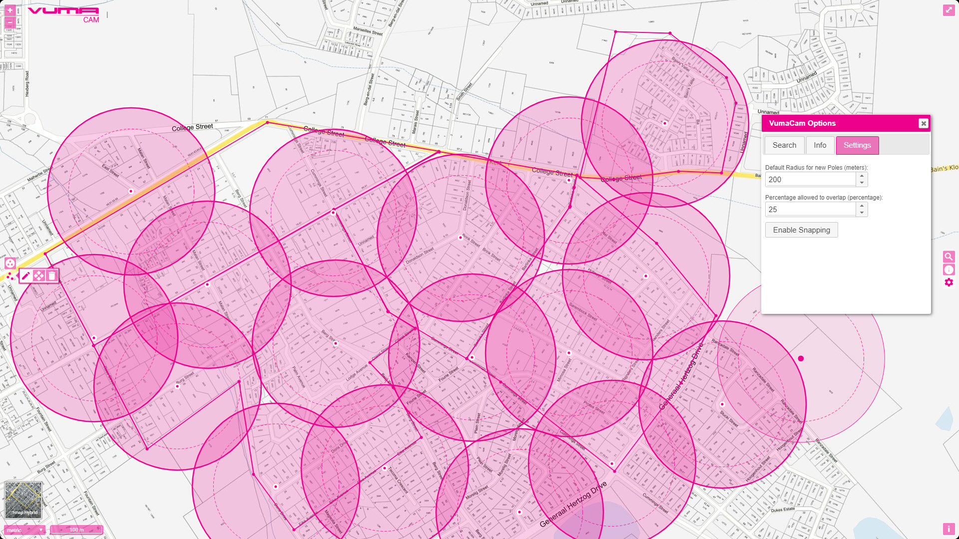 The user interface for capturing area polygons and individual wayleave points. The radius and allowable overlap for each point can be set dynamically.
Vumacam Wayleave App
1map developed a customised spatial application to greatly improve the efficiency of capturing information for wayleave applications.
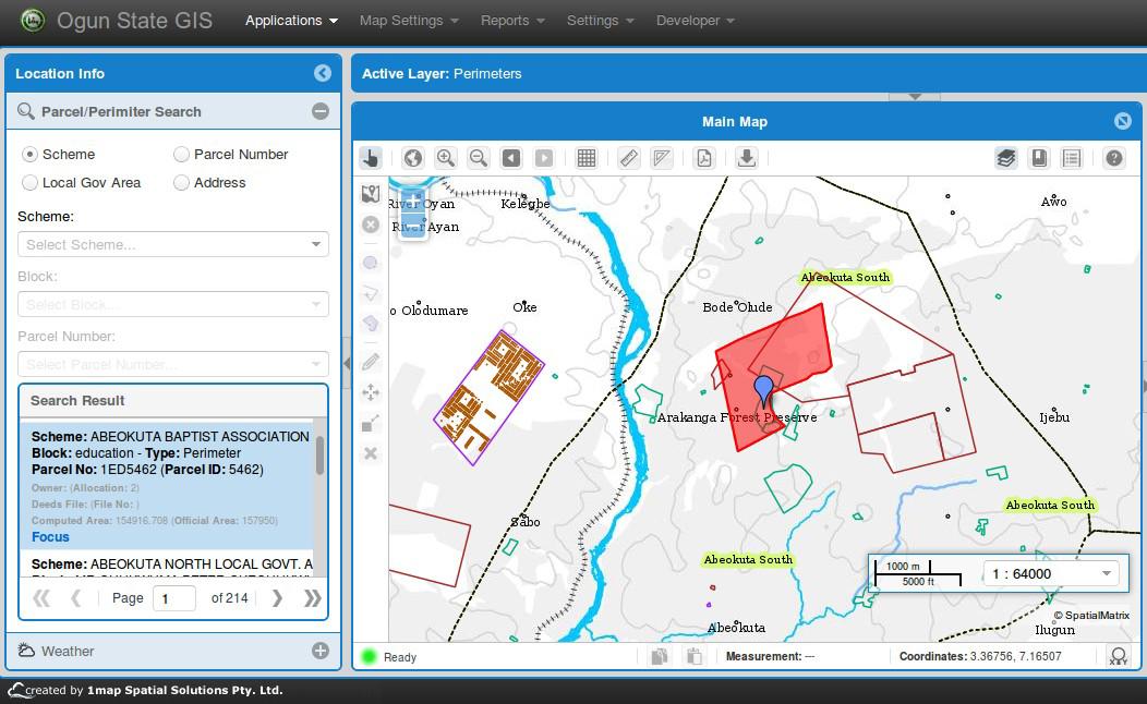 Ogun 1Map interface showing search panel with the panel and map showing the result of the search
Ogun State GIS: Nigeria
Ogun State in Nigeria started implementation in 2012 of their first digital Spatial Data Infrastructure (SDI). A custom implementation of the 1map Online GIS, with enhanced functionality such as a coordinate capture tool, was developed for the project.
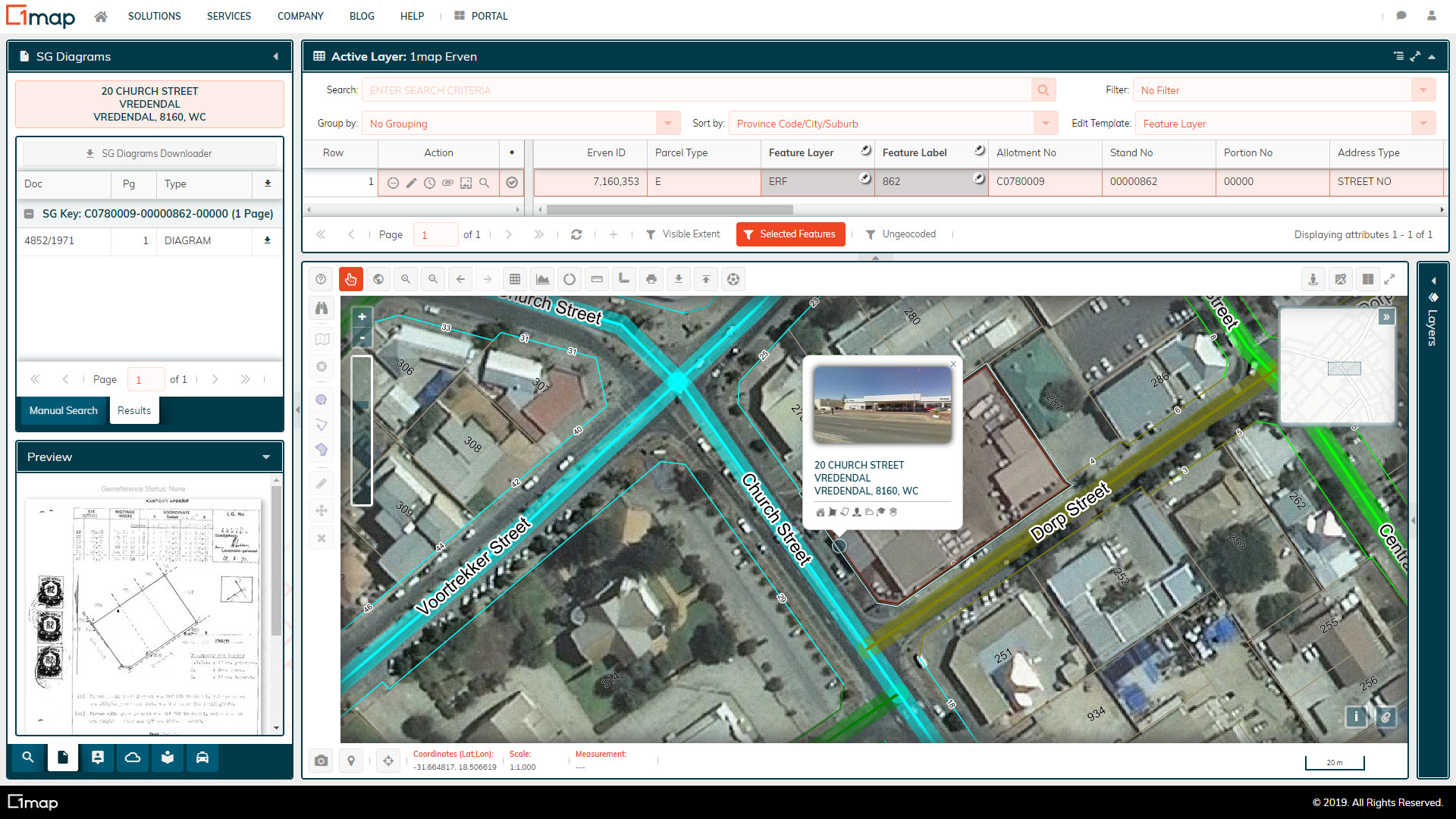 A screenshot of the Matzikama town center on the 1map Online GIS, showing the stand numbers, street addresses, road centrelines, SG diagrams, and NGI aerial imagery.
Matzikama Local Municipality
1map is used as the online GIS for Matzikamma Local Municipality, ensuring that all departments within the municipality that require access to spatial data have it at the click of a button.